
Home - Search - Browse - Alphabetic Index: 0- 1- 2- 3- 4- 5- 6- 7- 8- 9
A- B- C- D- E- F- G- H- I- J- K- L- M- N- O- P- Q- R- S- T- U- V- W- X- Y- Z
Metop
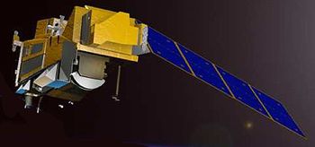 METOP-SG-A 1 Credit: Manufacturer Image |
Status: Operational 2006. First Launch: 2006-10-19. Last Launch: 2006-10-19. Number: 1 . Gross mass: 4,093 kg (9,023 lb). Height: 6.50 m (21.30 ft). Diameter: 5.20 m (17.00 ft). Span: 17.60 m (57.70 ft).
It represented the European contribution to a co-operative venture with the United States providing data to monitor climate and improve weather forecasting. The MetOp series of three satellites was to be launched sequentially over 14 years, forming the space segment of EUMETSAT's Polar System (EPS).
MetOp carried a set of 'heritage' instruments provided by the United States and a new generation of European instruments that offered improved remote sensing capabilities to both meteorologists and climatologists. The new instruments augmented the accuracy of temperature humidity measurements, readings of wind speed and direction, and atmospheric ozone profiles.
MetOp was equipped with high-resolution visible and infrared cameras, a microwave sounder, ozone monitors, a GPS atmospheric sounding device, a wind scatterometer, and a search and rescue package.
MetOp flew in a polar orbit corresponding to local 'morning' while the US was responsible for 'afternoon' coverage. The series provided data for both operational meteorology and climate studies. The combination of instruments on board MetOp had remote sensing capabilities to observe the Earth by day and night as well as under cloudy conditions.
Metop Characteristics were:
- Dimensions 6.2 x 3.4 x 3.4 meters (under the launcher fairing); 17.6 x 6.5 x 5.2 meters (deployed in orbit)
- Orbit: Sun-synchronous orbit, 09:30 mean local solar time (Equator crossing, descending node), Inclination 98.7 degrees, Period 101 minutes, Repeat cycle 29 days, Mean altitude 817 km
- Mass: 4093 Kg
- Payload mass: 931 Kg
- Power: 1812 W average power consumption (end-of-life)
- Mission duration: Six months commissioning followed by 4.5 years operational mission
MetOp carried a set of seven 'heritage' instruments provided by the United States' National Oceanic and Atmospheric Administration (NOAA) and the French Space Agency (CNES) and a new generation of five European instruments offering improved sensing capabilities to both meteorologists and climatologists.
Several of the instruments measured similar aspects of the atmosphere, namely temperature and humidity, but used a variety of measuring techniques to acquire their data. This approach was crucial for numerical weather prediction, which not only required high-quality observations but also needed huge amounts of data from different sources to feed into the models.
With its sophisticated array of instruments and diverse measuring techniques MetOp promised to provide outstanding data sets to advance the field of meteorology, which would ultimately improve the accuracy of weather forecasting and the understanding of climate change.
European instruments
Infrared Atmospheric Sounding Interferometer (IASI): IASI was one of the most advanced onboard instruments measuring infrared radiation emitted from the surface of the Earth to derive data of unprecedented accuracy and resolution on humidity and atmospheric temperature profiles in the troposphere and lower stratosphere, as well as some of the chemical components playing a key role in climate monitoring, global change and atmospheric chemistry.
The Microwave Humidity Sounder (MHS): MHS acquired measurements at various altitudes of atmospheric humidity, including rain, snow, hail and sleet, and temperature by measuring microwave radiation emitted from the surface of the Earth.
The Global Navigation Satellite System Receiver for Atmospheric Sounding (GRAS): GRAS was a Global Positioning Satellite (GPS) receiver that operated as an atmospheric-sounding instrument, providing a minimum of 500 atmospheric profiles per day through a process of GPS radio occultation. GRAS would supply atmospheric soundings of the temperature and humidity of the Earth's atmosphere.
Advanced Scatterometer (ASCAT): ASCAT, an enhanced follow-on instrument to the highly successful scatterometers flown on ESA's ERS-1 and ERS-2 satellites, measured wind speed and direction over the ocean. Its six antennas allowed for simultaneous coverage of two swaths on either side of the satellite ground track, providing twice the information of the earlier instruments. ASCAT also contributed to activities in areas as diverse as land and sea ice monitoring, soil moisture, snow properties and soil thawing.
Global Ozone Monitoring Experiment-2 (GOME-2): GOME-2 was a spectrometer that collected light arriving from the Sun-illuminated Earth's atmosphere or a direct view to the Sun and decomposed it into its spectral components. The recorded spectra were used to derive a detailed picture of the atmospheric content and profile of ozone, nitrogen dioxide, water vapor, oxygen, bromine oxide and other gases.
Heritage instruments (common to both MetOp and NOAA satellite payloads):
Advanced Microwave Sounding Units (AMSU-A1 and AMSU-A2): The AMSU instruments measured scene radiance in the microwave spectrum. The data from these instruments were used in conjunction with the High-resolution Infrared Sounder (HIRS) instrument to calculate the global atmospheric temperature and humidity profiles from the Earth's surface to the upper stratosphere. The data were also used to provide precipitation and surface measurements including snow cover, sea ice concentration and soil moisture.
High-resolution Infrared Radiation Sounder (HIRS/4): HIRS/4 was a 20-channel radiometric sounder measuring radiance in the infrared (IR) spectrum. Data from HIRS/4 was used in conjunction with data from the AMSU instruments to calculate the atmosphere's vertical temperature profile and pressure from the Earth's surface to about 40 km altitude. HIRS/4 data were also used to determine ocean surface temperatures, total atmospheric ozone levels, precipitable water, cloud height and coverage and surface radiance.
Advanced Very High Resolution Radiometer (AVHRR/3): AVHRR/3 provided day and night imaging of land, water and clouds and measures sea surface temperature, ice, snow and vegetation cover by scanning the Earth's surface in six spectral bands in the range 0.58 - 12.5 microns.
Advanced Data Collection System (A-DCS): A-DCS, provided by CNES, provided worldwide in-situ environmental data collection and Doppler-derived location services with the basic objective of studying and protecting the Earth's environment. A-DCS, also known as Argos, was an advanced version of the system presently operated jointly by NOAA and CNES.
Space Environment Monitor (SEM-2): SEM-2, provided by NOAA, was a spectrometer that provided measurements to determine the intensity of the Earth's radiation belts and the flux of charged particles at the satellite altitude. It also supplied knowledge of solar terrestrial phenomena and warnings of solar wind occurrences that might impair long-range communication, high-altitude operations, damage to satellite circuits and solar panels, or cause changes in drag and magnetic torque on satellites.
Search And Rescue Processor (SARP-3): SARP-3, provided by CNES, received and processed emergency signals from aircraft and ships in distress and determines the name, frequency and time of the signal. These pre-processed data were then fed into the Search And Rescue Repeater (SARR) instrument for immediate transmission to Search and Rescue Satellite (SARSAT) distress terminals on the ground.
Search And Rescue Repeater (SARR): SARR, provided by the Canadian Department of Defense through NOAA, received and down-linked emergency signals from aircraft and ships in distress and provided a down-link for data received by the Search and Rescue Processor (SARP-3). SARR received distress beacon signals on three separate frequencies, translated them and retransmitted them to Local User Terminals (LUTs) on the ground. These terminals processed the signals, determined the location of the beacons and forwarded the information to a rescue mission control center.
Electric System: 1.80 kWh.
More at: Metop.
Family: Earth, Earth weathersat, Sun synchronous orbit. Country: Europe. Launch Vehicles: R-7, Soyuz-2-1A, Soyuz-ST-B. Launch Sites: Baikonur, Baikonur LC31. Agency: ESA. Bibliography: 2, 6704, 12831.
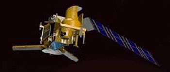 | METOP-SG-B 1 Credit: Manufacturer Image |
2006 October 19 - . 16:28 GMT - . Launch Site: Baikonur. Launch Complex: Baikonur LC31. LV Family: R-7. Launch Vehicle: Soyuz-2-1A.
- Metop-A - .
Mass: 4,093 kg (9,023 lb). Nation: Europe.
Agency: RKA.
Class: Earth.
Type: Weather satellite. Spacecraft Bus: SPOT-5A-5B.
Spacecraft: Metop.
USAF Sat Cat: 29499 . COSPAR: 2006-044A. Apogee: 817 km (507 mi). Perigee: 817 km (507 mi). Inclination: 98.70 deg. Period: 101.00 min.
European polar weather satellite equipped with high-resolution visible and infrared cameras, a microwave sounder, ozone monitors, a GPS atmospheric sounding device, a wind scatterometer, and a search and rescue package. First launch of the Soyuz 2 version of the venerable Soyuz launch vehicle. The main change in this first version of the new booster was a digital control system. Problems with this system delayed the launch repeatedly.
Back to top of page
Home - Search - Browse - Alphabetic Index: 0- 1- 2- 3- 4- 5- 6- 7- 8- 9
A- B- C- D- E- F- G- H- I- J- K- L- M- N- O- P- Q- R- S- T- U- V- W- X- Y- Z
© 1997-2019 Mark Wade - Contact
© / Conditions for Use